Canada’s Instrumentation Leader Since 1946.

Canada’s Instrumentation Leader Since 1946.

 Hoskin Environmental
Sampling and monitoring instruments for air, water, weather and soil for the environmental, agricultural, mining and research markets.

 Hoskin Geotechnical
Materials and Product testing for soil, asphalt, petroleum, concrete, mining, cement, and research industries.

 Hoskin Instrumentation
Sensors, transducers and instrumentation for industry, manufacturing, research and development and factory automation.
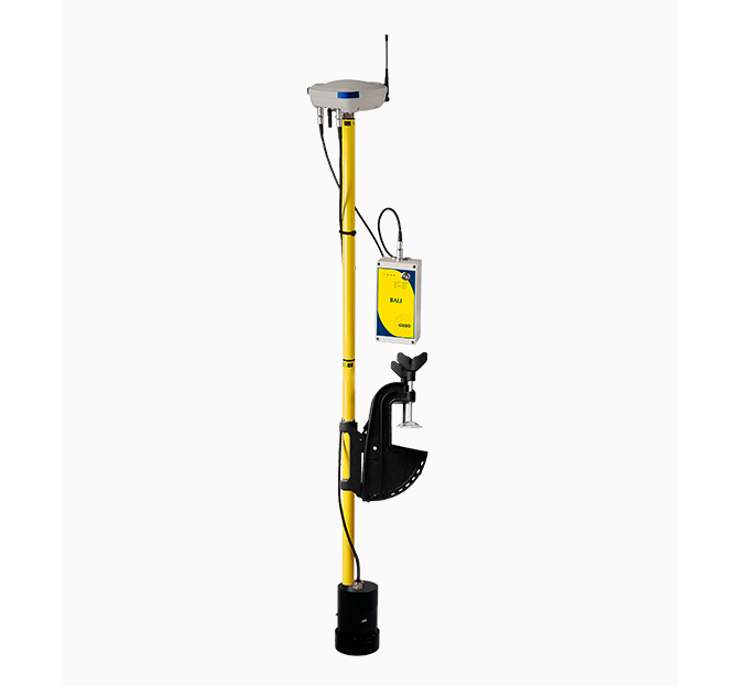
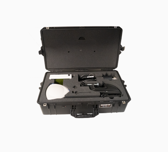
Compact and self-contained, BALI is an easy-to-operate, single-rod bathymetric measurement system. This lightweight bathymetry kit combines a single-beam bathymetric echosounder with an RTK GNSS receiver. It processes and stores water depth measurements synchronized with a georeferenced position with centimeter-level accuracy, even in difficult areas.
 Contact us for details
By default, the GNSS receiver inside the smart antenna is set to work with GPS+Glonass constellations. It is also possible to extend to Beidou+Galileo.
Receivers are powered by Trimble technology which automatically provides 3 levels of accuracy.
RTK: 1cm-2cm. L-Band (RTX): 4cm -10 cm. SBAS 0.5m-1m.
The NMEA output makes BALI compatible with any bathymetric software such as QINSy, HYPACK, etc. These can be connected either via an ethernet cable or via Wi-Fi. Survey data is stored internally and can be exported in standard file formats (.GPS, .SND, .CSV, .KMZ)
Sounding Rate: 5 times per second.
Depth precision: 99.5%
Power output from transmitter: 100 watts
Beam width: 9° (single freq. SBES) , 26° (dual freq. SBES)
The mono-frequency echo sounder works on 200 KHz and it is generally suitable for depths below 100m. When using the dual-frequency echo sounder, which works both on 200 KHz & 30 KHz frequencies, it is possible to increase the range to 200m limited by ping rate. Minimum depth reading: 0.4m, limited by pulse width.
The rechargeable Nickel–Metal Hydride (NiMH) battery provides autonomy of up to 10 hours. When using a dual-frequency SBES the autonomy is slightly reduced. Another factor affecting the power consumption is, for the RTK system, the type of modem used (GSM or UHF).
These type of battery is safer during transport as compared to Lithium-Ion batteries. An external battery can be connected to increase autonomy.
All antennas, modems, and firmware to make the kit communicate with various types of radio networks are embedded: 3G, UHF (410-470 MHz, ), and Wi-Fi.


Copyright - 2026 - Hoskin Scientific

