Canada’s Instrumentation Leader Since 1946.

Canada’s Instrumentation Leader Since 1946.

 Hoskin Environmental
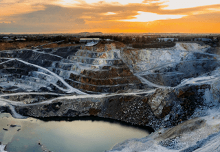
Sampling and monitoring instruments for air, water, weather and soil for the environmental, agricultural, mining and research markets.
 Hoskin Geotechnical
Materials and Product testing for soil, asphalt, petroleum, concrete, mining, cement, and research industries.
 Hoskin Instrumentation
Sensors, transducers and instrumentation for industry, manufacturing, research and development and factory automation.

Rent the DJI Matrice 350 RTK with the Zenmuse L2 LiDAR for a powerful, all-in-one aerial surveying solution delivering high-precision geospatial data. The M350 RTK offers enhanced flight stability, up to 55 minutes of flight time, IP55 weather resistance, and advanced RTK positioning for centimeter-level accuracy.
 Contact us for details
Rent the DJI Matrice 350 RTK with the Zenmuse L2 LiDAR for a powerful, all-in-one aerial surveying solution delivering high-precision geospatial data. The M350 RTK offers enhanced flight stability, up to 55 minutes of flight time, IP55 weather resistance, and advanced RTK positioning for centimeter-level accuracy. Paired with the Zenmuse L2, which integrates a high-precision LiDAR module, IMU, and a 4/3 CMOS RGB camera, this setup enables real-time point cloud rendering and dense vegetation penetration, making it ideal for topographic mapping, construction, forestry, and infrastructure inspection.
• Centimeter-level positioning with RTK for precise data capture
• High-efficiency LiDAR scanning with dense point cloud output
• Built-in RGB camera for colourized 3D models
• Seamless integration with DJI Terra for streamlined post-processing.
DJI Matrice 350, Zenmuse L2, 8 x Batteries, Propeller set (A), Propeller set (B), Micro Fiber Cloth, Cleaning Brush, Air Duster, Screw Driver, Manual, M3.0 Screws, M1.6 Screws, M1.6 Short Screws, Gimbal Dampeners, PSDK Cover, 4G Port Cover.


Copyright - 2026 - Hoskin Scientific

