Canada’s Instrumentation Leader Since 1946.

Canada’s Instrumentation Leader Since 1946.

 Hoskin Environmental
Sampling and monitoring instruments for air, water, weather and soil for the environmental, agricultural, mining and research markets.
 Hoskin Geotechnical
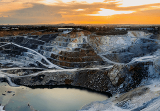
Materials and Product testing for soil, asphalt, petroleum, concrete, mining, cement, and research industries.

 Hoskin Instrumentation
Sensors, transducers and instrumentation for industry, manufacturing, research and development and factory automation.
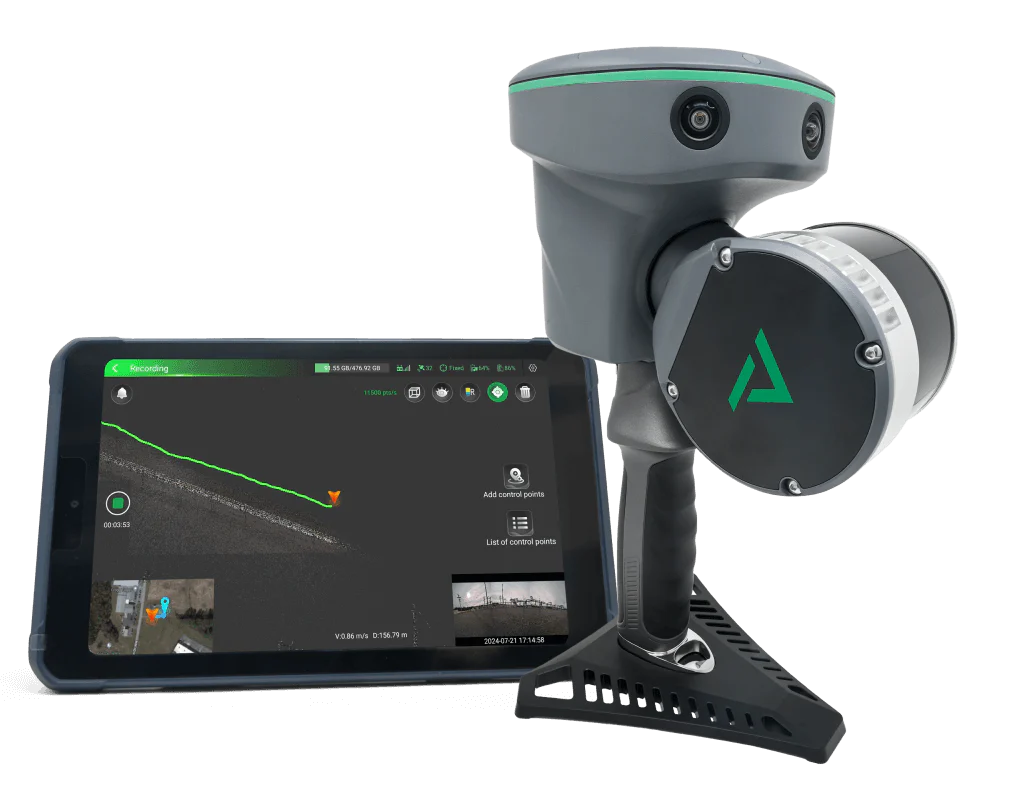
TrueView GO is revolutionary line of handheld 3D LiDAR mapping systems. Now available in two powerful versions - TrueView GO 116S and TrueView GO 132S - this product range brings together GNSS RTK accuracy, advanced SLAM technology, and visual reality capture in a compact, walkable system. TrueView GO transforms your movement into highly accurate digital twins.
 Contact us for details
Specialized LiDAR System for Precision Corridor Mapping
TrueView GO is revolutionary line of handheld 3D LiDAR mapping systems. Now available in two powerful versions – TrueView GO 116S and TrueView GO 132S – this product range brings together GNSS RTK accuracy, advanced SLAM technology, and visual reality capture in a compact, walkable system. TrueView GO transforms your movement into highly accurate digital twins.
| LiDAR | Range | Total RGB | LiDAR Returns |
| SLAM | 80 m @ 10% Reflectivity | 15 MP |
32/2 |
TrueView GO delivers powerful SLAM-based 3D scanning in indoor, subterranean, forested, and urban canyon environments, where GNSS signals are weak or absent. With real-time accuracy assessment and seamless loop-free data capture, TrueView GO ensures efficient and reliable mapping for:
Each TrueView GO includes LP360 LAND, GeoCue’s industry-leading software for processing handheld LiDAR and imagery:
TrueView GO Tablet Software further enhances the field workflow by enabling live data previews during scans, making sure every corner is captured
| Feature |
TrueView GO 116S |
TrueView GO 132S |
|---|---|---|
| Data Collection | LiDAR, Imagery, and SLAM | LiDAR, Imagery, and SLAM |
| Laser Scanner | Survey Grade, Class 1, Eye Safe laser @ 905 nm | Survey Grade, Class 1, Eye Safe laser @ 905 nm |
| LiDAR Range | 0.05 to 120 m | 0.5 to 300 m* |
| LiDAR Range – usable | 80 m @ 10% Reflectivity (channels 5 to 12) 50 m @ 10% (channels 1 to 4, 13 to 16) |
80 m @ 10% Reflectivity |
| LiDAR Beams/Returns | 16/2 | 32/2 |
| LiDAR FOV (Horizontal) | 270° | 270° |
| LiDAR FOV (Vertical) | (30°) (-15° to +15°) | 40.3° (-20.8° to +19.5°)* |
| Pulse Repetition Rate | 320 Khz | 640 Khz* |
| System Performance | Absolute accuracy: H: < 5 cm RMS (1) V: < 5 cm RMS (1) Relative accuracy: 1 cm |
Absolute accuracy: H: < 5 cm RMS (1) V: < 5 cm RMS (1) Relative accuracy: 1 cm |
| Camera Sensor |
Three 5 MP cameras (15 MP) |
Three 5 MP cameras (15 MP) |
| Camera FOV | 210° × 170° | 210° × 170° |
| System Operation Temperature Range | -20° to 50° C | -20° to 50° C |
| Mass | 1.9 kg (including RTK and battery) | 1.7 kg (including RTK and battery)* |
| Power Supply Mode | Lithium battery, supports hot-swapping and portable charger | Lithium battery, supports hot-swapping and portable charger |
| Working Time from a Single Battery | 1 hr | 1 hr |
| Data Storage | 512 GB | 512 GB |
| Field of View | 360° x 270° | 360° x 270° |
| Loop-free Data Acquisition | Yes | Yes |
| Real-time Accuracy Assessment | Yes | Yes |
With GNSS RTK/PPK + SLAM fusion, the TrueView GO enables precise, real-time point cloud creation—even when satellite data is unreliable. Its advanced sensors allow:
Remote Measurements – Capture 3D points without direct access
Loop-Free Path Planning – No need for circular paths; scan freely
Real-Time Feedback – Visualize coverage as you move
It integrates seamlessly with major drone platforms such as:
DJI. Inspired Flight, Skyfront. Freefly, Wispr, Harris Aerial, XER
Why TrueView GO?
It’s a compact, easy-to-use system combining LiDAR, imagery, and SLAM for multi-environment scanning.
What makes it unique?
True GNSS + SLAM fusion, live data preview, LP360 LAND integration, and flexible sales models.
Who is it for?
Surveyors, engineers, construction professionals, conservationists, public safety officers, and more.
What’s the difference between 116S and 132S?
Channel count (16 vs. 32), extended range, and enhanced data density with the 132S.
Can I use LP360 Cloud or LP360 Drone with TrueView GO data?
Yes. Data from GO can be fused with drone/mobile collections in LP360.
What’s the support coverage?
1-year warranty and software support with online training included.


Copyright - 2026 - Hoskin Scientific

