Canada’s Instrumentation Leader Since 1946.

Canada’s Instrumentation Leader Since 1946.
 Hoskin Environmental
Sampling and monitoring instruments for air, water, weather and soil for the environmental, agricultural, mining and research markets.
 Hoskin Geotechnical
Materials and Product testing for soil, asphalt, petroleum, concrete, mining, cement, and research industries.

 Hoskin Instrumentation
Sensors, transducers and instrumentation for industry, manufacturing, research and development and factory automation.
April 2026


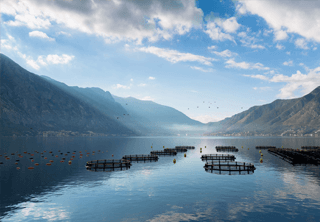
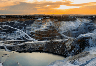
Conducting environmental research, resource extraction, or infrastructure management in Canada presents a unique set of logistical challenges. From the isolated expanses of the Beaufort Sea to the rugged terrain of the St. Elias Mountain Range, accessing critical environmental data has historically required expensive, dangerous, and time consuming manual field expeditions.
Today, the landscape of environmental science and industrial compliance has fundamentally shifted. Organizations can no longer rely on sporadic, manual data collection to make operational decisions or satisfy stringent regulatory requirements. The demand is for continuous, highly accurate, real time data, regardless of how remote or hostile the location might be.
This is where the deployment of custom remote environmental monitoring systems becomes not just advantageous, but essential. In this comprehensive guide, we will explore the architecture of integrated systems, the power of modern data telemetry, and why partnering with Hoskin Scientific is the definitive solution for capturing critical data in the world’s most extreme environments.
An integrated monitoring system is far more than just a collection of sensors bolted to a tripod. It is a highly engineered, cohesive network designed to capture, process, and transmit specific environmental parameters reliably, day after day, without human intervention.
When designing these systems, our engineering team focuses on three core pillars:
The foundation of any system is the instrumentation. Depending on the project’s scope, a single station may need to simultaneously monitor hydrometric flow, soil moisture, ambient temperature, wind velocity, and geospatial positioning. The challenge lies in ensuring that diverse sensors—often manufactured by different companies—communicate flawlessly with a central data logger. Our team specializes in this complex integration, ensuring that every parameter is captured with absolute scientific precision.
In remote locations, plugging into a municipal power grid is impossible. Therefore, power management is often the most critical point of failure in a remote system. Our integrated systems utilize advanced, redundant power solutions, typically combining high efficiency solar panels with deep cycle battery banks engineered to perform in sub zero temperatures. For locations that experience months of polar night, such as our deployments in the Antarctic, we engineer specialized low draw systems and alternative power generation methods to ensure uninterrupted operation.
Collecting data is only half the battle; retrieving it from a remote wilderness is the true challenge. This is where real time data telemetry in Canada becomes vital. We design systems that utilize the most reliable communication pathways available for the specific geographic location. This includes:
Since 1946, Hoskin Scientific has been the Canadian leader in environmental and industrial instrumentation. We do not just sell equipment; we engineer solutions. Our integrated systems have been successfully deployed in some of the most unforgiving environments on Earth.
For example, working alongside the University of Manitoba, we designed monitoring systems deployed directly onto ice floes in the Beaufort Sea. These stations provide near real time data on climatic factors and geospatial movements, surviving the crushing forces and extreme cold of the Arctic Ocean.
Similarly, our team designed the hydrometric and dam safety monitoring network for Ontario Power Generation. This massive network of 64 monitoring locations feeds real time data back to regional control centers, allowing operators to make split second decisions regarding water levels and power generation across the Ottawa, Madawaska, and St. Lawrence River systems.
From the highest weather station in the tropical Andes (deployed with the National Geographic Society at over 20,000 feet) to the Tor Research Station in Antarctica, our systems are proven to deliver reliable data when failure is not an option.
Designing, programming, and deploying integrated climate monitoring stations requires a highly specialized skill set. Attempting to build these systems in house often leads to frustrating compatibility issues, power failures, and lost data.
When you partner with Hoskin Scientific, you leverage over 75 years of expertise. Our dedicated Integrated Systems team works directly with your scientists, engineers, and project managers to understand your exact data requirements. We handle the entire process: from initial sensor selection and custom programming to final assembly, rigorous testing, and field deployment support.
Whether you are monitoring ground water remediation at a remote tungsten mine or tracking climate change in the Yukon, we ensure you have continuous access to the data you need to drive your project forward.
What is an integrated environmental monitoring system?
An integrated system is a custom engineered network of scientific sensors, a central data logger, an autonomous power supply, and a telemetry communication device, all designed to work together to collect and transmit environmental data from remote locations without human intervention.
How does remote data telemetry work in extreme environments?
Remote data telemetry utilizes various communication networks to transmit data from the field back to a central server or cloud platform. Depending on the location’s isolation, this is achieved using cellular networks, localized Radio Frequency (RF) systems, or global satellite networks like Iridium, ensuring data delivery from anywhere on Earth.
Why hire Hoskin Scientific for custom monitoring stations?
Hoskin Scientific brings over 75 years of specialized expertise to the design and deployment of monitoring stations. Our engineering team handles the complex integration of diverse sensors, programs the data loggers, designs resilient power systems for extreme weather, and ensures reliable telemetry, eliminating the risk of data loss for your critical projects.
What types of parameters can an integrated system monitor?
Our systems can be customized to monitor virtually any environmental or industrial parameter, including meteorological data (wind, temperature, precipitation), hydrometric data (water level, flow rate, water quality), geotechnical data (soil moisture, ground movement), and geospatial positioning.


Copyright - 2026 - Hoskin Scientific

