Canada’s Instrumentation Leader Since 1946.

Canada’s Instrumentation Leader Since 1946.
 Hoskin Environmental
Sampling and monitoring instruments for air, water, weather and soil for the environmental, agricultural, mining and research markets.
 Hoskin Geotechnical
Materials and Product testing for soil, asphalt, petroleum, concrete, mining, cement, and research industries.

 Hoskin Instrumentation
Sensors, transducers and instrumentation for industry, manufacturing, research and development and factory automation.
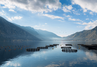
Lake bathymetry monitoring refers to the process of measuring and studying the underwater depth or topographic map of a lake. This is crucial for understanding various aspects of the lake's ecology, including its volume, shape, and habitat complexity.
Lake Bathymetry Monitoring Products
If you're looking to study the underwater depth for flood monitoring, Hoskin Scientific has you covered. Our products are reliable and accurate, ensuring that you have the data you need to make informed decisions. Trust Hoskin Scientific for all your meteorology and weather needs.


Copyright - 2026 - Hoskin Scientific

